Peel Forest Lodge

Peel Forest Lodge

Peel Forest Lodge (Peel Forest,Новая Зеландия)

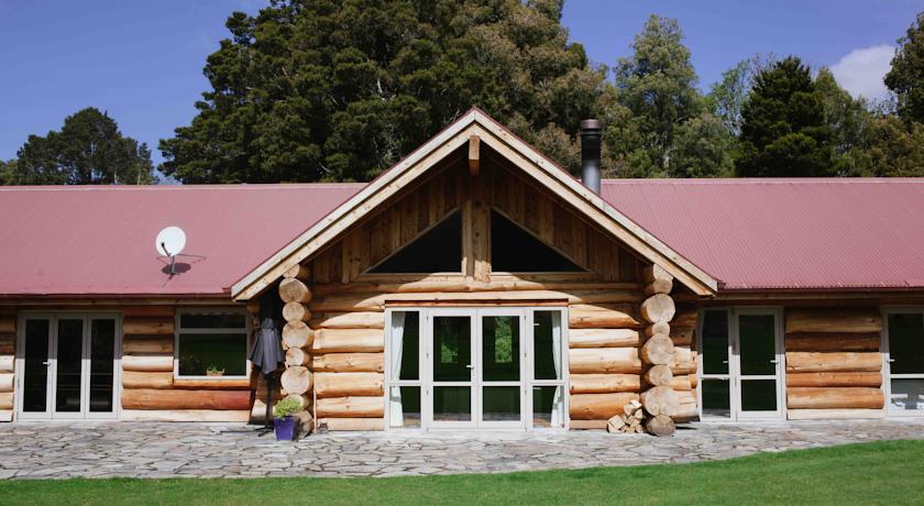
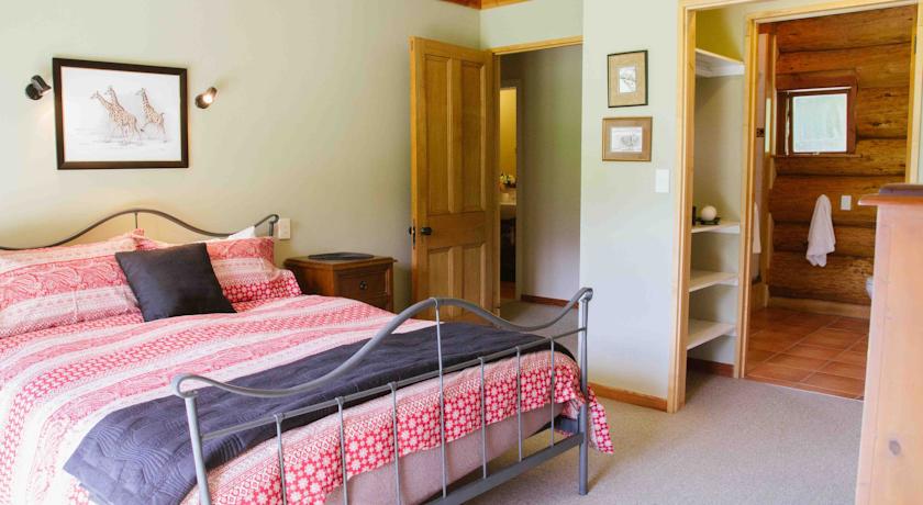
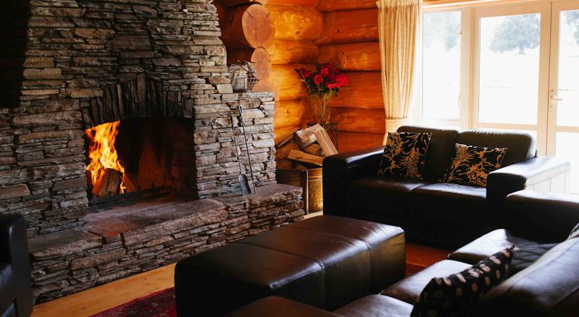
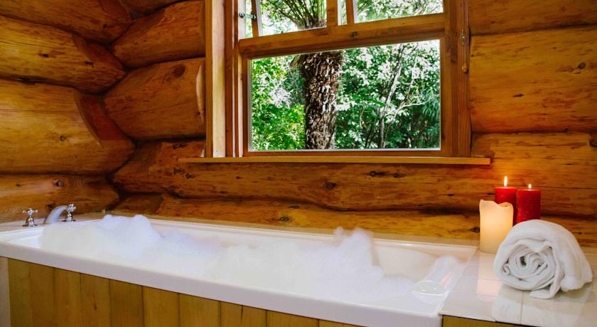
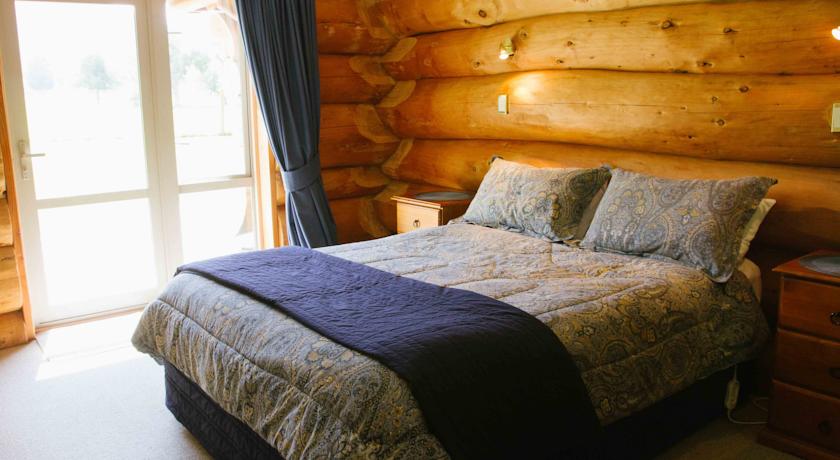
Категория отеля: 4-звездочный отель
Адрес: 96 Brake Road, Peel Forest, Geraldine, 7992 Peel Forest, Новая Зеландия
Описание: В распоряжении гостей виллы Peel Forest Lodge с прекрасным видом на горы 4 спальни с каменным камином, гидромассажная ванна и бесплатный WiFi. Гости могут отдохнуть на вилле, которая оснащена отоплением, и воспользоваться полностью оборудованной кухней и принадлежностями для барбекю.Вилла Peel Forest находится в 5 минутах езды от реки Рейнджитата и в 20 минутах езды от города Джеральдин. До виноградника Опихи можно доехать за 40 минут, а до горнолыжной зоны Маунт Хатт - за 1 час.В распоряжении гостей обеденная зона, 2 гостиные зоны, телевизор с плоским экраном и спутниковым телевидением, а также DVD-плеер. Кроме того, к вашим услугам открытая обеденная зона и стиральная машина. В собственной ванной комнате установлена ванна и предоставляется фен и бесплатные туалетно-косметические принадлежности.Вилла располагает отдельным бунгало с двуспальной кроватью, собственной ванной комнатой и мини-кухней.По запросу для гостей организуются занятия конным спортом и сафари в парке Пил Форест.
Еда и питье:
На свежем воздухе: Барбекю
Парковка: Бесплатно! Бесплатная Частная парковка на месте (предварительный заказ не требуется) .
Услуги: Номера для некурящих, Курение на всей территории объекта размещения запрещено
Спорт и отдых: Верховая езда, Гидромассажная ванна
Сервис:
Интернет: Бесплатно! Wi-Fi предоставляется на территории всего отеля бесплатно.
Языки общения:
Время заезда/выезда: 14:00 - 21:00 / 07:00 - 11:00
Домашние животные: Размещение домашних животных допускается по предварительному запросу. Данная услуга может быть платной.
Банковские карты: visa,euromastercard,eftpos,
Номерной фонд: Загородный дом: 4 номера
Координаты: ш. -43.90871087055461 д. 171.2493896484375 на карте
 

Каталог отелей.

Игры ⚽ Поможем решить контрольную работу

Полезное


Смотреть что такое "Peel Forest Lodge" в других словарях:

  • Peel District School Board — Board office location Mississauga, Ontario, Canada Board identifier B66125 Number of schools …   Wikipedia

  • Kielder Forest — is a large forestry plantation in Northumberland, England. It is the largest forest in the UK, covering an area of 500 km² [ [http://www.forestry.gov.uk/forestry/INFD 6QLLGP Forestry Commission England North East Managing our woodlands ] ] .… …   Wikipedia

  • High Sheriff of Cheshire — The High Sheriff is the oldest secular office under the Crown. Formerly the High Sheriff was the principal law enforcement officer in the county but over the centuries most of the responsibilities associated with the post have been transferred… …   Wikipedia

  • King John's Palace — viewed from the south east King John s Palace, King s Clipstone is the remains of a once magnificent medieval royal palace in north west Nottinghamshire. The name King John s Palace has been used since the 18th century, prior to that the site was …   Wikipedia

  • Civil parishes in Cheshire — A map of Cheshire, showing the Boroughs : (1) Cheshire West and Chester; (2) Cheshire East; (3) Warrington; and (4) Halton. A civil parish is a subnational entity, forming the lowest unit of local government in England. There are 332 civil… …   Wikipedia

  • List of communities in Ontario — Communities in the province of Ontario, Canada Note: this is an incomplete list of communities, not necessarily organized municipalities. For organized municipalities see list of municipalities in Ontario and for census subdivisions see list of… …   Wikipedia

  • Cuddington, Eddisbury — Coordinates: 53°14′24″N 2°36′01″W / 53.240°N 2.600297°W / 53.240; 2.600297 …   Wikipedia

  • List of zoos — The following is a partial list of zoological gardens (zoos):AfricaAlgeria*Algiers Zoo *Oran ZooCameroon*Mvog Betsi ZooCôte d Ivoire*Abidjan ZooEgypt*Giza Zoo *Alexandria Zoo *Qariyet El Assad (Lions Village)Ghana*Flagstaff House Zoo *Kumasi… …   Wikipedia

  • Leicester — For other places with the same name, see Leicester (disambiguation). Coordinates: 52°38′03″N 1°08′19″W / 52.63422°N 1.13852°W / …   Wikipedia

  • Billings, Montana — Billings redirects here. For other uses, see Billings (disambiguation). Billings, Montana   City   Billings skyline with the Beartooth Mountains in …   Wikipedia


Поделиться ссылкой на выделенное

Прямая ссылка:
Нажмите правой клавишей мыши и выберите «Копировать ссылку»